
Our Mission
The Atascadero / Green Valley Watershed Council's mission is to bring together the people who live, own property or work in the watershed, and others who care about it, to help each other in taking responsibility for our impact on the watershed, through protection, restoration, and education.
The Atascadero / Green Valley Watershed Council is a California nonprofit unincorporated association.
The Atascadero / Green Valley Watershed Council is a California nonprofit unincorporated association.
Location: Sonoma County, California
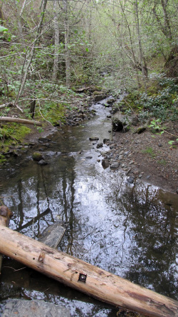
The Atascadero and Green Valley Watershed is a water basin situated west of the city of Sebastopol in Sonoma County, California. Those of us that live here like to think of this special place as our little piece of heaven.
Atascadero Creek
The upper reaches of Atascadero Creek form in the gently rolling open hills beginning north of the Burnside Road ridgeline. Flowing north past Barnett Valley Road the creek crosses Watertrough Road and skirts the western edge of the city of Sebastopol; the wide ribbon of riparian cover in this reach makes identification of the creek easy. Between Bodega Highway and Mill Station Road, the creek flows through Ragle Ranch Regional Park where it is joined from the west by Jonive Creek, a major contributor to the waterway's winter flow.
After crossing Occidental Road, the Atascadero continues flowing north within sight of the Joe Rodota Trail. It forms the western edge of the town of Graton between Graton Road and Green Valley Road. At Green Valley Road the slow moving wide creek forms a natural wetland that survives past the spring rains: this area is owned by the California Department of Fish and Game.
Green Valley Creek
The upper reaches of Green Valley Creek form in the steep redwood covered slopes west of Harrison Grade Road. During its east-flowing course, the creek crosses Green Valley Road three times: once near little-known Bundy Avenue, again just east of Harrison Grade Road where it switches from the north to the south side of Green Valley Road, and a third time west of Sullivan Road. In the reach between Harrison Grade and Sullivan, the creek is joined by Purrington Creek, a major water contributor that forms the valley through which Graton Road runs.
The Atascadero merges with Green Valley Creek at the wetlands owned by the Department of Fish and Game northwest of the town of Graton. Green Valley Creek then flows toward Pocket Canyon and crosses Highway 116 just west of Forestville. The final reach of the creek forms the valley that Martinelli Road runs through. The creek joins the Russian River near Martinelli and River Roads.